 |
|
 |
|
|
|
|
 |
|
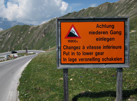 |
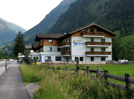
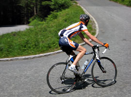
| Left: Landgasthof Wasserfall in Fusch, our last accommodation during the 2010 tour. Middle: Ward at the final climb to Enzigerboden (Stubachtal). Right: Warning - not applicable to cyclists ! - for 12% descents at the Großglockner Hochalpenstraße (see next page). |
| Cycling
the Großglockner pass was our final goal for the 2010 tour. Read
more about it on the next page. To avoid driving home on a busy Friday,
we decided to spend another day in the Tauern region. First we explored
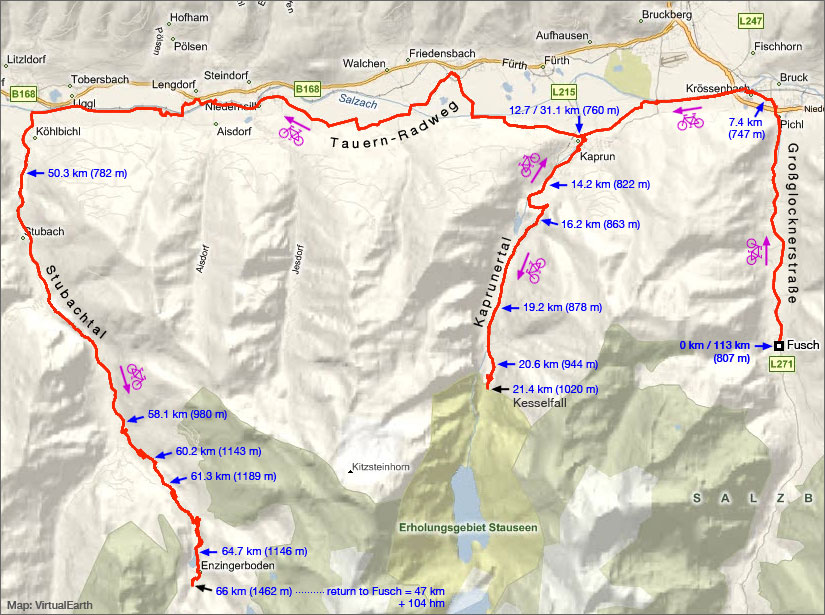
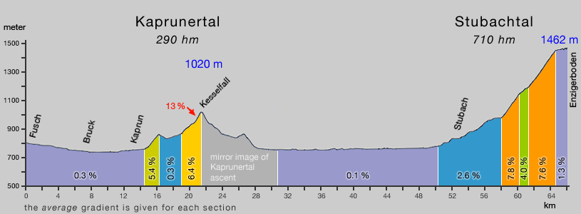
two adjacent valleys: the Kaprunertal and Stubachtal. The Kaprunertal was a bit disappointing. Only less than 9 km are cyclable. After Kesselfall, with a multistory parking garage, cycling is no longer allowed. You have to take a shuttle bus to the "Erholungsgebiet Stauseen", a large reservoir at 1675 m. To reach the next valley we have taken the Tauern Radweg (direction Mittersill) for 18 km. A flat, easy going cycle path and a nice boost to our average speed of that day. The next 17 km to Enzigerboden, at the end of the Stubachtal, was most pleasant. A scenic valley with an attractive, good quality road. Not much cars and only a few motor bikes ! |
| Below: map and gradient profile of the route through the Kaprunertal and Stubachtal. |
 |
 |

Tracks, distances, profiles and gradients are based on Garmin Edge 705 data
| start page | Jaufenpass Timmelsjoch |
Sella Gardena Campolongo Pordoi |
Fedaia | Santa Lucia Giau Falzarego |
Gardeccia Ciampie |
Kaprunertal Stubachtal |
Großglockner |