 |
|
|
|
|
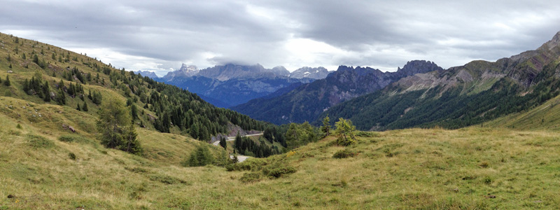 |
| View from Passo di Valles in easterly direction. |
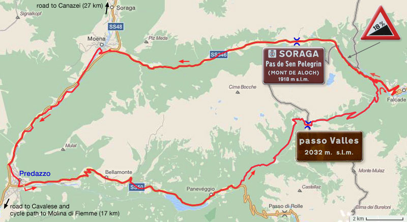
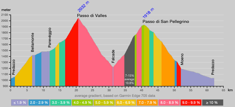
| Both
the Passo di Valles and Passo di San Pellegrino have been climbed in
five Giro d'Italia stages. We have combined the two in a loop,
starting in Predazzo. The chosen counter clockwise direction of cycling
offers the most challenging ascents for both Valles and Pellegrino. The
18% warning halfway the Pellegrino ascent is a bit 'optimistic'; my GPS
indicated a maximum of 15.5%. Note that the Pellegrino pass sign gives the name in
local Dolomitic Ladin, a dialect of the Rhaeto-Romance language. Mont
de Aloch is the name that has been used in the past. Pass and
surrounding area are a part of territory of the distant community of
Soraga. The road from Predazzo to to Panevéggio is quite busy, but most traffic goes to, or comes from the Passo di Rolle. The SS48 from Moena to Predazzo is an even more busy section, but fortunately a cycle path offers a pleasant alternative. Another cycle path connects Predazzo with Moline di Fiemma (see previous map). The cycle path follows the river Avisio along the south bank, while the main road is north of the river. |
 |
 |
| Click
here for gpx.zip file of GPS data of the above track (62.1 km, 2067
waypoints). |
 |
 |
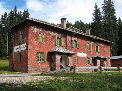
| A Casa Cantoniera near Panevéggio, build
by A.N.A.S., a former government
owned company deputed to construct and maintain motorways and state
highways. Highways were divided into sections. Many sections had a Casa
Cantoniera. They served as living for road supervisors, and offered space to store
materials. From the 1980s many houses fell into disuse. Case
Cantoniere always have the same characteristic red color, based on a
natural pigment that was already used in Roman times, hence
its Italian name: rosso pompeiano. |
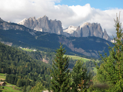
Part of the Catinaccio / Rosengarten
massive seen from Moena. |
| start page | Ventertal
and Ötztaler Gletscherstrasse |
Passo di
Pampeago and Passo di Oclini |
Redango di
Sopra and Anterivo |
Passo
di
Valles and Passo di San Pellegrino |